


Turn forest and climate insight into business value. 360Carbon helps you anticipate risks, optimize your forests and uncover strategic opportunities-faster.
Carbontracer© helps you with the planning, capturing, monitoring and maintananace of existing or new trees, forests and ecosystems.
Our platform combines field data with a robust library of remote sensing data, saving you manual labour, helping to mitigate vegetation risk and increases the resilience against future climate change impact.
Our Services
Our platform for Monitoring, Reporting and Verification (dMRV) enables real-time tracking of green spaces, trees, forests, and agroforestry projects.
The integrated Forestry Management Tool supports cash-crop farmers and forest owners via mobile app in implementing maintenance plans and ongoing management, while providing alerts on potential vegetation risks.
With our EO-based data modules, the health, growth, and biodiversity of forests and ecosystems can be monitored and measured to strengthen climate resilience and biodiversity.
![]()
Forestry Management
The Forestry Management Tool supports farmers, cities, communities, and forest owners with ongoing maintenance and provides alerts on vegetation risks. By avoiding data silos and increasing efficiency, it helps you save time and resources.
![]()
Forest & ecosystem Monitoring
A digital platform for planning, monitoring, and analyzing forests. The combination of EO data with field data provides precise and scientifically validated insights.
![]()
Prediction & Risk mitigation
Through our integrated data modules, the health, growth, and biodiversity of forests and ecosystems are continuously measured and captured, strengthening the climate resilience of green spaces and forests.
Discover our platform solutions to ensure climate resilience for your forests.

Monitoring Forest health
Use satellite and ground data insights to build climate-resilient forests through early detection of stress, pests, and disease.
Predicting Yield & Supply
Forecast biomass and yields using vegetation indices and weather data to improve planning and supply chain stability.
Land use and Deforestation tracking
Detect land-use changes and deforestation in real time to ensure compliance and protect ecosystems.
Forest Planning Tool
With the help of satellite data and land insights, Carbontracer simplifies forest planning to reduce labour costs and coordinate field operations efficiently.
Forest Management
Easily implement and manage forestry plans, assign tasks, and cut costs with streamlined team coordination tools.
Compliance
Verify sustainable practices to support compliance and ensure full supply chain transparency.
Data driven. Scientifically based. Full transparency. Make your impact visible with Carbontracer
Together with our team of geospatial specialists, we offer a digital solution that connects companies with scientifically validated agroforestry and forestry projects.
For forest projects, data on growth and health status can be accessed at any time to strengthen climate resilience and data transparency for third parties.
For agroforestry projects, condition, growth, and yield forecasts can be provided. Our tool also supports the maintenance of green spaces and forests with a unique task management feature for field workers
- Real-time forest monitoring
- Predictive data analysis for risk mitigation & increased climate resilience
- Forest management tool to help ground teams with forest & ecosystem maintanance
Why 360carbon?
This makes us different.
![]()
From Data to Decisions
Simplified access to powerful geospatial analysis – we transform complex environmental data into actionable insights that accelerate your sustainability goals and agroforestry strategies.
![]()
Enterprise-grade security
Your security is our priority. We leverage ESRI’s enterprise-grade encryption and authentication to protect the confidentiality, integrity, and availability of your data.
![]()
Datadiversity
Access a wide selection of nature and climate data from globally recognised providers known for their scientific excellence. Whether you’re analysing biodiversity, climate risks, or land use, we have the data for you.
![]()
Scientific forest insight
Our scientifically-verified dMRV platform captures forest data with unprecedented accuracy, combining multi-source geospatial intelligence with rigorous field validation for forest management you can trust.
![]()
Certification
Measuring and monitoring follow the goals of science-based targets and comply to international certification standards.
![]()
Partnership model
Collaborative projects with farmers or foresters provide economic, ecological, and social benefits to farmer and communities.
Meet 360carbon.
A network of innovation, science and hands-on mentality.
Based in Zurich, 360Carbon is a collaborative company driven by the shared vision of building climate technology rooted in science, nature, and innovation. Our software is the result of close partnerships across Switzerland—combining deep expertise in environmental science with cutting-edge technology.
We work with a trusted ecosystem of organizations to ensure impact, scalability, and transparency:
-
MYBLUEPLANET
Implementation of high-integrity reforestation projects across Switzerland. -
KONTUR ZÜRICH
Leveraging satellite-based geospatial data to supply us with precise remote sensing data to support our software platform and ecosystem management.
![]()
![]()

Clive Hildering
CEO & Founder
His love for forests stems from spending every free moment running, biking, or snowboarding among them.
With over 20 years of international experience in sustainability across Europe & Africa, Clive has advised clients on sustainability strategies and decarbonizing their real estate portfolios. He has supported a wide range of listed companies on achieving net-zero targets and integrating technology-driven sustainability solutions.
Through 360Carbon, Clive’s vision is to provide the Global North and South with access to Earth Observation (EO) infrastructure for forests and agroforestry, combining field data with remote sensing to deliver actionable insights without the need for coding expertise or costly tools.
He holds a master’s degree in Architecture and several executive-level sustainability qualifications.

Noel Gorelick
CTO / Technology Advisory
Dr. Noel Gorelick is a scientist and software engineer with several decades of experience in large scale analysis of satellite data.
He worked on 7 NASA spacecraft missions to the Moon, Mars and Saturn, and is one of the founders of Google Earth Engine, a planetary-scale data analysis platform embraced by more than 500,000 users around the world. As Chief Extraterrestrial Observer at Google, he helps scientists, governments, and NGOs use it to address some of society’s biggest challenges like drought, disaster, disease and deforestation.
At 360Carbon he acts as Chief Technology Officer.
#makeyourmark
This is the home for stories and news happening between the trees.
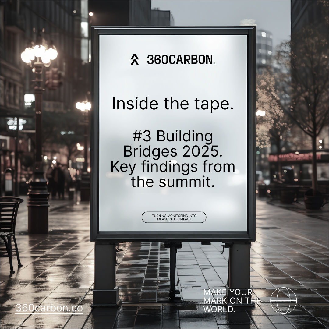
Key findings from the Building Bridges summit.
As part of Building Bridges 2025, having the great opportunity of connecting with a wide range of individuals from a broad range of industry sectors and was overwelmed by the interest in our digital platform solution. Here are my key findings of the summit: #1 There might currently be uncertainty around financial investment into nature-positive […]
Read More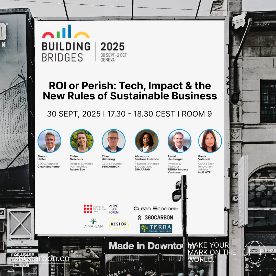
Join 360Carbon at Building Bridges Conference 2025.
Clive Hildering, CEO of 360Carbon, will join leading sustainability experts from Restor, Terra Impact Ventures, Clean Economy, Dimarjan, and HomeofBlockchain.swiss for a fishbowl panel discussion at BuildingBridges25 in Geneva. ROI or Perish – Tech, Impact & the New Rules of Sustainable Business We’ll explore: Why current ESG practices have fallen short — and how to […]
Read More
360Carbon supports trail therapy.
When last did you trade screens for trails? There is nothing better than ripping through a forest-feeling the terrain, catching the fresh air and finding that perfect flow state where nothing else matters. We at 360Carbon not only support the efforts against global forest deforestation by providing a unique digital platform, but we also actively […]
Read More
Welcome MYBLUEPLANET.
We are looking forward to working with MYBLUEPLANET! The climate foundation uses innovative solutions to motivate people and companies in Switzerland to act in a sustainable way. In 2007, the tree planting project MyBlueTree was created, where trees are planted as a visible and lasting symbol for MYBLUEPLANET’s climate projects. Since then, thousands of trees […]
Read More
Welcome Korua Snowboards.
We are excited to welcome Korua Snowboards on board! Korua, with a deep appreciation for turning on snow, are the shapers of innovative snowboard shapes. They are just as passionate as 360Carbon in spending every possible minute amongst snow-covered forests. There boards have been reduced and optimised for best possible performance on the slopes and […]
Read More
Welcome Red Horizon Mining.
We are excited to welcome Red Horizon Mining as a new partner! Over the next two years, a biodiverse restoration project will be implemented across 45 hectares of their land in northern South Africa. With 360Carbon’s Carbontracer, our innovative dMRV tool, we will support the management and monitoring of the new forests to optimize growth […]
Read More
Inside the tape. #2 Key findings of the carbon market summit.
These are our key takeaways of the 2024 NYC Climate week, focussing on the Carbon Market summit. The market. Carbon Markets are here to stay and grow. There are global efforts in improving the regulation, certification and alignment of standards of the voluntary carbon market. We felt that there is an expectation and general optimism […]
Read More
Carbontracer, our dMRV tool for your forests.
Our approach accounts for every single tree and helps forest growers with the monitoring and management of their forests. Carbontracer consists of two elements, the dashboard and the App. The Dashboard helps forest growers with the planning of new forests and monitoring the ongoing forest growth and health. It is aligned along main certification body […]
Read More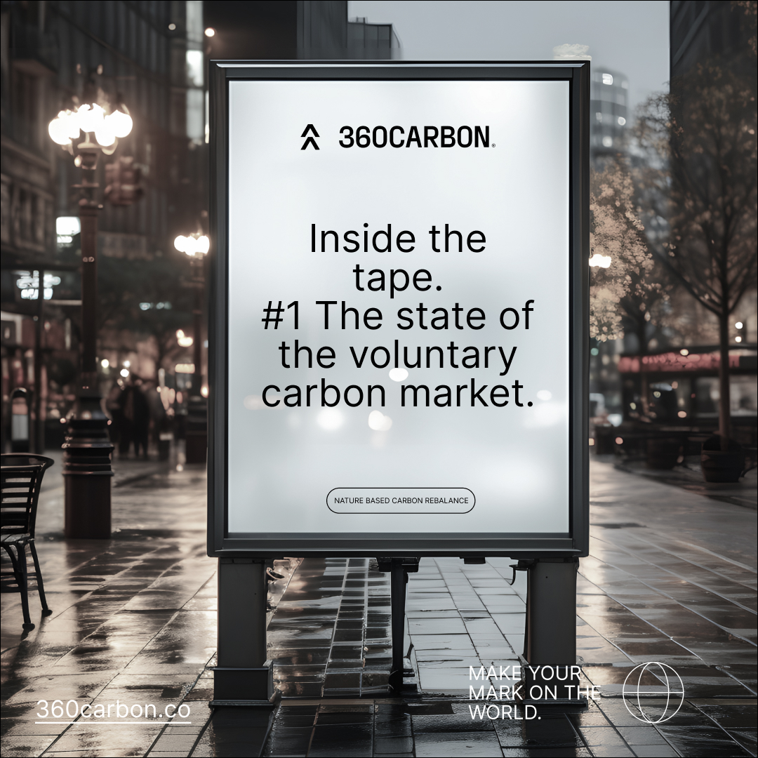
Inside the tape. #1 The state of the voluntary carbon market 2024.
In the last couple of days a range of key reports haven been published on the state of the voluntary carbon market and CDR (carbon dioxide removal). In addition, the work by the EU is continuing in standardizing the monitoring and certification of CDR methods through the CRCF regulations, while the U.S. Government is pushing […]
Read More
Enjoy the last rainforests of Europe with Red Bull Hardline
The world’s toughest and most progressive downhill mountain bike race returns to Wales, marking its 10th anniversary in the iconic Dyfi Valley. Its probably one of the hardest tracks, but slightly harder than the riders is the forest covering the Welsh hillsides. The forests are one of the last rainforests to be found in Europe. […]
Read More![]()
360carbon (Ltd)
Streulistrasse 28
Zürich | Switzerland
hello@360carbon.co